

by Anushka Verma
Updated: October 28, 2025
Driving through Indian cities is an art form in itself. From chaotic crossroads to confusing flyovers, and from narrow gullies to nameless colonies, navigation here requires more than just technology — it needs a deep understanding of India’s geography, diversity, and behavior on the road.
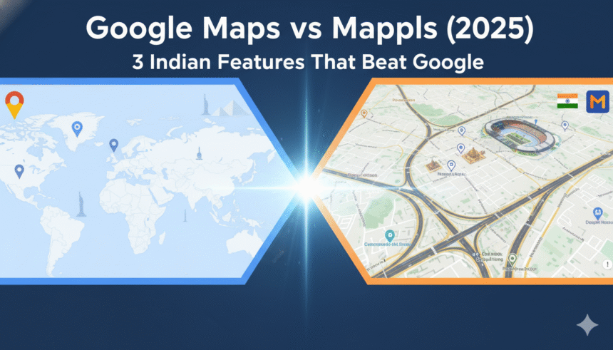
For years, Google Maps has been the undisputed leader in digital navigation — not just globally, but across India too. Whether you are heading to a café in Delhi or a temple in Madurai, it’s the first app you open. But lately, a powerful local alternative has emerged — Mappls, the made-in-India mapping platform developed by MapmyIndia, the company that has been mapping the country since the 1990s.
While Google Maps continues to excel in worldwide navigation and data coverage, Mappls has built features that directly solve India’s ground-level problems — from the chaos of unstructured addresses to poor road quality. And that’s exactly why it’s becoming a serious competitor, especially among users who prioritize accuracy, privacy, and localization.
India’s Navigation Challenge
India’s geography isn’t just vast — it’s complex. With more than 6.3 million kilometers of roads, countless unmarked streets, and neighborhoods often identified by landmarks rather than official addresses, no global app can fully comprehend the chaos.
For example, asking someone to find “House No. 9, Lane 2, Near Old Hanuman Mandir” can easily turn into a guessing game for most apps. Google Maps can often get you close — but not exactly there. That’s where Mappls steps in.
The homegrown mapping service focuses on solving India-specific navigation challenges, such as incomplete addresses, inconsistent road names, or multiple languages.
And unlike global mapping systems, Mappls doesn’t just replicate global data — it redefines how navigation works for Indian roads, Indian users, and Indian realities.
Google Maps vs Mappls: Detailed Comparison (2025 Edition)
| Feature | Google Maps | Mappls |
|---|---|---|
| Developer | Google Inc. (USA) | MapmyIndia (India) |
| Primary Focus | Global coverage, real-time traffic | Indian localization, precision mapping |
| Navigation Quality (India) | Excellent in metros; weaker in rural areas | Optimized for Indian roads, even remote ones |
| Address Accuracy | Moderate; often relies on landmarks | Precise with “Mappls Pin” system (doorstep-level) |
| Real-Time Traffic Updates | Global crowd-sourced data | AI-based localized traffic prediction |
| 3D Junction/Flyover View | Limited | Full 3D visualization of junctions, flyovers, exits |
| Speed Breaker & Pothole Alerts | Rare | Frequent and detailed road hazard alerts |
| Fuel & Trip Cost Estimation | Not available | Available for petrol, diesel, CNG & EVs |
| EV Charging Data | Partial | Detailed EV route planning with stations |
| Offline Navigation | Yes | Yes |
| Languages Supported | 10+ global languages | 12+ Indian languages |
| Privacy & Data Control | Tracks user data for ads | No ad tracking, data stored in India |
| Integration | Strong with Android Auto, Google services | Integrates with Indian government & logistics apps |
| Street View Availability | Extensive (urban areas) | Expanding; includes Indian government data |
| Price | Free | Free |
| Target Audience | Global users | Indian drivers, logistics, EV users |
| Launch Year (App) | 2005 | 2021 (rebranded from MapmyIndia) |
1. The Power of the Mappls Pin – India’s Address Revolution
One of the biggest pain points in India’s navigation story has been addresses. Many homes, shops, and even offices do not have a standard, mappable address. Streets are often unnamed or repeated in multiple locations.
While Google Maps tries to approximate these using user-contributed data, Mappls created an elegant Indian solution — the Mappls Pin.
Each Mappls Pin is a unique six-character code that corresponds precisely to a location — right down to your doorstep. For instance, DLX45T could be your exact home location, and sharing this Pin ensures anyone — courier, guest, or emergency vehicle — reaches you directly.
Why Mappls Pins Matter
- Simplicity: No need for complex directions or spelling errors.
- Precision: Each Pin is geo-coded to within a few meters.
- Language Neutral: It works regardless of whether the user speaks Hindi, Tamil, Bengali, or English.
- Reliability: Works offline and even in network-deprived rural zones.
In contrast, Google’s “Plus Codes” serve a similar function but lack deep Indian integration — they’re not yet widely adopted by local businesses or logistics networks.
Mappls, however, is partnering with India Post, Zomato, and Swiggy, and even state governments to adopt Mappls Pins as official digital addresses.
This is a made-in-India innovation solving a uniquely Indian problem — and it’s one of the main reasons users are switching.
2. 3D Junction Views: Clarity in Chaos
If you’ve ever been confused about whether to take the flyover or the service road, you’re not alone. It’s one of the most common problems for drivers in India’s multi-level intersections.
Google Maps, though highly accurate, often presents flat 2D visuals that make complex intersections hard to understand.
Mappls, however, provides realistic 3D junction and flyover views — allowing drivers to visualize their route before they reach the turn. The app also marks entry and exit points with clear arrows and lane guidance.
Why This Is a Game-Changer
- Prevents Wrong Turns: Drivers can see whether to stay on the flyover or take the underpass.
- Saves Time: Avoids missed exits that cause long detours.
- Improves Safety: Less confusion at high-speed intersections.
- Better for Tourists: New drivers in unfamiliar cities benefit from visual cues.
Mappls’ 3D interface feels like a digital twin of the road network, created through AI-driven topographical modeling and drone mapping.
In a dense metro like Delhi or Mumbai, this kind of visualization makes a massive difference.
3. Smart Road Alerts – Made for Indian Roads
Google Maps does a good job showing live traffic and accident reports, but it’s not designed for India’s unpredictable road surfaces.
Mappls takes it further with “Smart Road Alerts.”
The app notifies drivers in advance about speed breakers, potholes, road closures, construction zones, speed cameras, and accident-prone areas.
These features might sound simple, but in India — where road conditions change daily — they can save lives, time, and money.
How Mappls Collects This Data
Mappls uses a mix of:
- Crowdsourced reports from drivers
- Government data integration
- AI-based road condition scanning
- Partnerships with vehicle telematics systems
So, when you’re driving at night and approaching an unmarked speed breaker, Mappls will alert you before your suspension finds out the hard way.
This kind of context-aware safety mapping doesn’t exist on Google Maps — and it’s precisely the kind of localization Indian users appreciate.
The Privacy Edge: Data Stays in India
Another major reason for Mappls’ rising popularity is privacy.
Google Maps, part of the larger Google ecosystem, uses navigation data for ad targeting and behavioral analytics. Every route, search, and location visit can be part of your advertising profile.
Mappls, in contrast, operates on a no data-sharing policy. The company’s servers are based in India, and user data stays within national jurisdiction.
This matters at a time when data protection and sovereignty are top national concerns.
For businesses like defense, logistics, or government agencies, this local control over geospatial data makes Mappls not just an alternative — but a necessity.
Localization and Indian Integration
What sets Mappls apart isn’t just what it does differently, but how deeply it integrates with India’s ecosystem.
The app supports 12+ Indian languages, including Hindi, Tamil, Telugu, Bengali, Marathi, and Punjabi. Users can not only search but also hear directions in their preferred language.
Mappls also collaborates with:
- Government of India Smart City initiatives
- Electric Vehicle manufacturers (for EV charging data)
- Delivery companies and logistics startups (for precise address mapping)
It’s not a repurposed global product — it’s built from scratch for Indian infrastructure.
Fuel Cost and EV Route Estimation
Another standout feature is trip cost calculation. Mappls lets users estimate the total travel cost based on:
- Fuel type (Petrol, Diesel, CNG, or Electric)
- Distance and traffic conditions
- Vehicle efficiency
This helps both regular users and fleet managers plan efficient routes.
For EV drivers, Mappls shows charging stations along the route, including charging type (fast or standard), availability, and estimated charging time.
This level of detail gives Mappls a real edge as India rapidly transitions to electric mobility.
Why Google Maps Still Wins Globally
Despite Mappls’ India-focused innovations, Google Maps remains unmatched in scale.
Its strengths include:
- Massive global coverage and business listings
- Seamless integration with Android Auto and Wear OS
- Advanced public transport and ride-sharing options
- Billions of user contributions improving map data every day
For travelers, multinational users, and global navigation needs, Google Maps remains the default choice.
But in the Indian context — where localization, privacy, and address precision matter most — Mappls feels more personal, contextual, and relevant.
Mappls Pricing and Availability
Both apps are free to use, but Mappls also offers premium enterprise solutions for:
- Logistics companies
- Government agencies
- Real estate developers
- Automotive manufacturers
These premium tools include fleet tracking, analytics, and advanced map APIs, all hosted on Indian servers.
You can download Mappls from the Google Play Store or Apple App Store, and it’s compatible with Android Auto, Apple CarPlay, and even smart dashboards of Indian EVs like Tata Nexon EV and MG ZS EV.
The Future of Navigation in India
As India grows smarter and more connected, its mapping needs will evolve.
Google Maps has been a phenomenal foundation, but the next phase of navigation in India will likely be data-sovereign, hyper-local, and privacy-driven — and that’s exactly where Mappls fits in.
With 3D navigation, real-time hazard alerts, fuel estimation, and Pin-based addressing, Mappls is not trying to replace Google Maps globally — it’s redefining navigation locally.
For now, many Indians may continue to use both — Google Maps for broad discovery and Mappls for precision travel within India.
Final Verdict: Can Mappls Replace Google Maps in India?
If your needs are global, Google Maps still reigns supreme.
But if you’re looking for accuracy, privacy, and an India-first approach, Mappls is the smarter choice.
It may not yet match Google’s data volume, but its innovation in areas that matter to Indians — local address systems, road safety, and language accessibility — gives it a genuine competitive edge.
And in a time when “Made in India” products are proving their mettle globally, Mappls is more than just an app — it’s a symbol of India’s digital independence.