

It is easy to picture the Great Pyramid of Giza standing isolated against sand and heat, as if it had always belonged to a desert that never changed. That image has shaped how the monument is discussed for centuries, especially the question of how such heavy stone blocks ever reached the plateau in the first place.
The Nile today sits several miles away, separated from the site by dry ground that feels too wide to be practical for ancient transport. The Nature study shifts that distance in a quiet but unsettling way, suggesting the landscape was not always arranged like this. Buried traces in the soil hint at a water channel that has long since disappeared, something that once ran much closer to the pyramids than the modern river ever does.
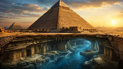
Hidden wetland traces beneath the sands of the Great Pyramid of Giza
Beneath the baked surface east of the Giza plateau, layers of sediment hold fragments of an older environment. A team working through these deposits identified microscopic plant remains that do not fit the current desert conditions. Among them were species normally tied to marshes and slow-moving water, the kind that sit at the edge of a living river system rather than open sand.According to the study published in Nature, titled ‘The Egyptian pyramid chain was built along the now abandoned Ahramat Nile Branch’, the presence of these remains lines up with the idea that an ancient arm of the Nile once passed near the pyramid fields.
It has been given the name Khufu Branch in modern research, though it would have been just another part of the river system at the time. The suggestion is not that the Nile was entirely different, but that one of its channels has since shifted or faded away, leaving only faint geological hints behind.
What tiny pollen grains reveal about the Nile’s forgotten branch
The work behind this picture does not rely on anything dramatic at first glance. Instead, it comes from narrow cores drilled into the ground, pulling up columns of sediment that stretch back thousands of years.
Inside those thin samples sit pollen grains, tiny enough to be missed without careful sorting.What stands out is not a single plant type but a mixture that belongs to wetter conditions. Papyrus, sedge-like plants, and other vegetation associated with river margins appear together in a way that suggests sustained water presence rather than a brief flood event. Taken on its own, a pollen grain tells very little. Stacked together across layers, they begin to sketch a shifting environment.
In this case, one that points towards a functioning waterway near the pyramid complex during the era of Khufu, Khafre and Menkaure.
Ancient logs suggest easier water transport to Giza
Another thread does not come from soil but from papyrus. Fragments of a record kept by an official named Merer, found in the Red Sea region at Wadi al-Jarf, describe teams moving limestone under organised supervision. The writing is practical, almost routine in tone, dealing with deliveries and transport rather than ceremony or politics.What makes it relevant is the route implied in those notes. Stone quarried at Tura is recorded as being moved by boat towards the Giza area. That only makes straightforward sense if there was a navigable stretch of water reaching close enough to the pyramid site to be useful. The logistics carry their own implication. Heavy blocks, barges, a working water corridor that connects quarry and construction ground without requiring long overland haulage.When placed alongside the environmental evidence, the writing starts to feel less like an isolated administrative record and more like a snapshot of a working landscape that has since changed shape.
What the climate was doing in the background
The existence of a now-vanished Nile branch sits inside a much wider environmental shift. Northern Africa did not always have the same dry character it does today. During a wetter phase thousands of years ago, large parts of what is now desert supported grasslands, lakes and seasonal water systems.That period gradually ended as long-term changes in solar patterns altered rainfall across the region. Water sources retreated, vegetation thinned, and channels that once carried steady flow began to weaken or disappear. The Khufu Branch appears to have been part of that slow withdrawal, holding on long enough to be present during the pyramid-building centuries before fading out.There is no sharp break visible in the record. It reads more like a drawn-out contraction, a river system losing strength bit by bit until only the main Nile channel remained dominant.
How water routes may have shaped pyramid building
The image of pyramid construction often assumes a fixed backdrop, as if the geography of Giza had always been stable. What this evidence suggests instead is a setting that was still in transition while the monuments were being built.A closer water route would have changed the practical rhythm of construction. Stone arriving by boat rather than being dragged across long desert tracks alters not just efficiency but the entire scale of what was possible.
The plateau would have been less isolated, more directly tied into the river’s working network.
What remains beneath the sand
Today, the Nile sits far from the pyramids, and the space between them feels fixed. Yet the subsurface record tells a different story, one where water once reached further inland and then slowly withdrew. Pollen grains and papyrus fragments are not dramatic evidence on their own, but together they outline a landscape that no longer exists in visible form.The pyramids remain where they were placed, but the river that may have supported their construction no longer passes that way.